


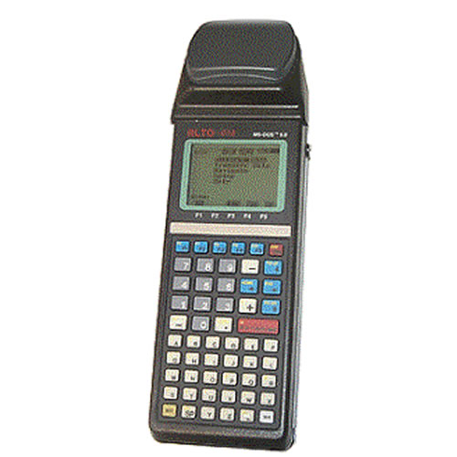
CMT MC-GPS L1 Hand Held GPS/GIS Data Collector
- Brand: CMT (CorvallisMicroTechnplogy Inc.). USA
- Product Code: MC5-GPS-38-PKG
- Availability: 10 - 14 Working Days
- Rp.72,500,000
Tags: Garmin, GPS Receiver
The choice for foresters. Works well under tree canopy. Includes the industry's only built-in TRAVERSE function to let you collect positional data even when GPS signals are not available, such as in extremely dense canopy situations or in caves. The rugged MC-GPS has been in the market for over six years. Thousands of units are utilized in rough forest terrain. A proven and reliable GPS unit for GIS applications
NMEA / Barcode Device Interface Capabilities - Two 9-pin RS-232 serial ports, PC/AT pinout.
- The ALTO-G12 has two waterproof DB-9 RS-232 serial ports (COM1: and COM2:) for communication with your PC as well as a variety of additional input and output devices such as:
RTCM-104 Version 2.0: Real-time DGPSSimply plug your RTCM-104 source (i.e. FM pager, VHF radio, WADGPS) into the ALTO-G12's COM1: port. The ALTO-G12 will automatically detect and use the RTCM message. Since the ALTO-G12 has two DB-9 serial ports, you can use COM1: for RTCM and still have COM2: available for a barcode reader or NMEA output to another instrument. Don't worry if you lose the RTCM message while you are collecting data; the ALTO-G12 can be set to collect raw data and will automatically warn you so you can post-process your data.Compatible with Coast Guard Beacon Receiver . Obtain real-time differential correction with CMT's Coast Guard Beacon Receiver package.
NMEA 0183 outputThe ALTO-G12 will send out a NMEA 0183 message, at an interval specified by you, to either COM1: or COM2:. This functionality allows the ALTO-G12 to output a GPS position to devices (i.e. digital cameras, sonar, etc.) that will accept a NMEA 0183 message. There is no need to change your instrument settings. The ALTO-G12 communications can be set to match your instrument. In the NMEA Setup screen, you have complete control over the baud rate and protocol settings.
Efficient Data Entry with Bar Code Input Attach a bar code scanner to the ALTO-G12 and you can quickly enter data. Bar code menus can be set up in such a way that you never need to touch the ALTO-G12 keyboard.
The MC-GPS package includes CMT's PC-GPS software for comprehensive GPS project management and mapping. PC-GPS provides functions for Mapping, Mission Planning, Batch Differential Correction, Static Point "Spread" analysis and Job Editing. The software also supports GIS layering, raster images (i.e. DOQs, DRGs, aerial photographs, satellite imagery), multimedia objects (OLE 2.0) and Microsoft® ODBC.
Efficient Data Entry with Bar Code Input
The MC-GPS package includes CMT's PC-GPS software for comprehensive GPS project management and mapping. PC-GPS provides functions for Mapping, Mission Planning, Batch Differential Correction, Static Point "Spread" analysis and Job Editing. The software also supports GIS layering, raster images (i.e. DOQs, DRGs, aerial photographs, satellite imagery), multimedia objects (OLE 2.0) and Microsoft® ODBC.
System Features:
- 6-channel L1 frequency
- Full wavelength carrier phase on L1
- Carrier-phase smoothing
- Up to 1 Hz position update rate
- Up to 1 Hz code & phase measurements
- 1 PPS timing signal
- Superior performance under tree canopy
Data Collector Features:
- Waterproof (submersible)
- Audible beeper
- Operating temperature: -40°C to 54°C
- 8 line x 21 character backlit display
- 3 MB RAM standard (5 MB, 8 MB optional)
- Fully integrated GPS receiver, antenna and data collector in one hand-held unit
- 55-key alphanumeric keyboard including 5 function keys and separate numeric keypad
- Optional external antenna
- Rechargeable battery
CMT Field Software v3.8
- Collect Points, Lines Areas
- Feature/Attribute/Value GIS structure
- Graphic plotting.
- Traversing keyboard data entry to allow you to continue mapping when GPS is obstructed
- Offset function to map hard-to-reach locations.
- Nested point function for tagging points while you are mapping a Line or Area Feature.
- Averaging function to optimize accuracy while recording static points.
- LLA/UTM/SPC plus user-defined coordinates.
- Supports 50 datums plus user-defined datums.
- Provides area calculation in the field
- Interfaces to laser rangefinders, barcode readers and various NMEA devices
- Canyon, Blockage and Clear modes for optimal tracking performance
What's in the Box:
- (1) Field Software Version 3.8
- (1) PC-GPS Version 0.9
- (1) 3 Megabyte RAMDISK
- (1) PC Transfer Cable
- (1) (1) RTCM Input/NMEA Output
- (1) Batteries and Smart Chargers for Receiver & System Battery
- (1)Spare Smart Charger for GPS-ENG-BAT-G3 w/3 charge modes and charge status LED.
- (1) C/A Code Differential
- (1) Carrier Phase Differential
- (1) Spare 2100 mAh GPS Engine Battery (Charge with ACC-SMC-G2-L)
- (1) 220 Volt Spare Wall Battery Charger for ALT-BATPAK
- (1) Nylon Carrying Case for MC-GPS
- (1) External Antenna, 2M cable, Rangepole, Tripod and Pole Holder
- (1) User Manual
Brochure/Datasheet
Instruction manual
Catatan: Harga tidak mengikat, sewaktu waktu bisa berubah tanpa pemberitahuan dahulu

An excellent unit for precision agriculture, hydrographic surveys, and utility mapping.Signal inaccu...
Rp.101,700,000
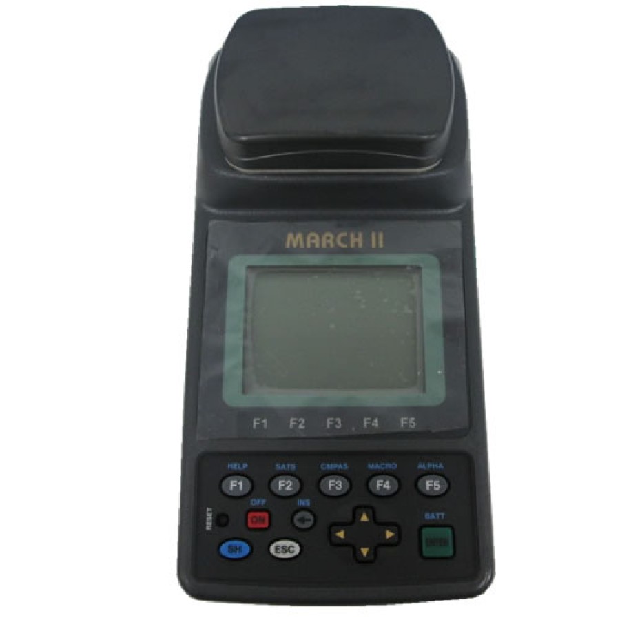
The MARCH is a compact, cost effective, integrated GPS/GIS data collector, ideal for small data coll...
Rp.88,500,000