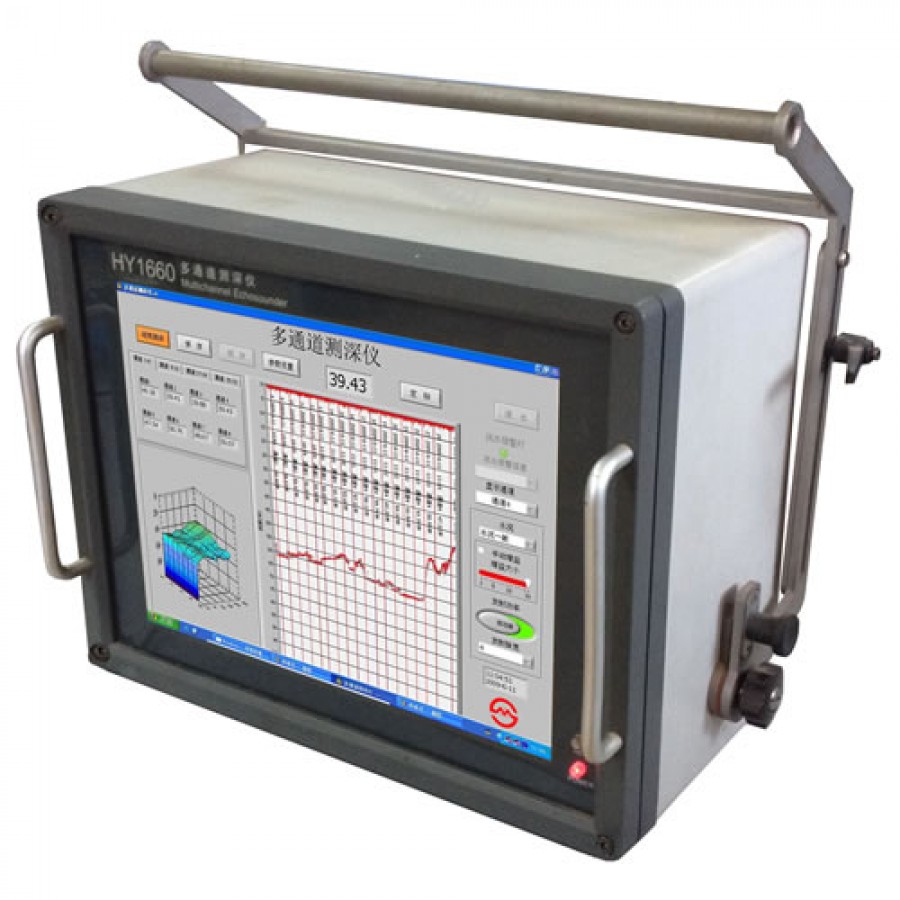
Smart Max Geosystem HY1660 Multi-channel Echosounder Sweep System
- Brand: Smart Max Geosystems
- Product Code: HY1660
- Availability: 2 - 3 Weeks
- Rp.875,500,000
Tags: Smart Max Geosystem, Single-Frequency, Thermal Printer, Echosounder
HY1660 Multi-channel Echosounder Sweep System is a hydrographic
echosounder specifically designed for use in harbors,canals,rivers and
other shallow bodies of water. Especially for use in those application
including large area shallow water surveying, detecting and locating
debris or other hazards to navigation in harbors, rivers or canals,
monitoring the charted safe depth of navigable waterways, monitoring
dredging or underwater construction operations and so on.
This compact multi-channel echosounder, based on Windows XP
software, employs not only very reliable embedded main board and
redundant RS232/422/USB ports, but also those advanced technology
involving with channel control, image display and bottom detection. A
15inch large scale LCD display can simultaneously monitor both 2-32
channels of depth and bottom profile. All data is shown in 3-D and in
real time using a color-coded waterfall display which graphically
represents areas of common depth using different colors. While sweeping
depth data can be simultaneously exported through a RS232/422 port to
third part survey software running on the same computer.
Features:
- Specially suited for use in shallow water below 50 meter
- Channel combination available from 2 to 32 simultaneously, based on Windows XP and 15 inch LCD display
- Equipped with redundant RS232/RS422/USB ports to output/input raw data
- Water depth from Multi-channels can be simultaneously stored in the computer's hard driver permanently
- Event marker operated from menu or by manual and can be searched automatically
- Raw data and a time-related 3-D echogram from any channels can be displayed, replayed on screen
- Any motion sensors can be interfaced to have a dynamic compensation.
What's in the Box:
- (1) Smart Max Geosystem HY1660 Multi-channel Echosounder Sweep System
- (1) Tranducser
- (1) Manual
Specifications:
- Channels: 2-32 available on request
- Range: 10,20,30,40,50 meters adjustable
- Power consumption: approx.80W
- Working mode:time sharing, 8 pings,16 pings per second vary with the range
- Pulse width: 0.05,0.1,0.2, and 0.4ms adjustable
- Frequency: 208kHz (Beam width ≤8〇 )
- Accuracy: ±(0.01m+ 0.1% D), D stands for the depth surveyed
- Resolution: 1cm
- Output power: 50W
- TVG Curve: available
- Interface: 3 RS232 ports(COM1,COM3,COM4);1 RS422 COM2 port; Other ports: 1 printer port, 1 ethernet network, 2 USB ports
- Screen display: 15 inches LCD
- Hard drive: 80G
- Power supply: AC 180V-260V
- Working conditions: Ambient temperature:0℃-40℃;Relative humidity:≯ 85%
- Storage conditions: Ambient temperature:-40℃-55℃; Relative humidity:≯ 85%
- Main Unit: Dimensions: 430mm*360mm*230mm; Weight: 15KG
- Juction Box: Dimensions: 330mm*230mm*110mm; Weight : 5KG; Length of cable: 10m and weight 1Kg
- Transducer: Dimensions: 80mm*80mm; Weight: 1.5KG; Length of cable: 10m (available up to 100m on request)


